
Alaska
⎪ALASKA: Denali, St. Elias, and the Chugach
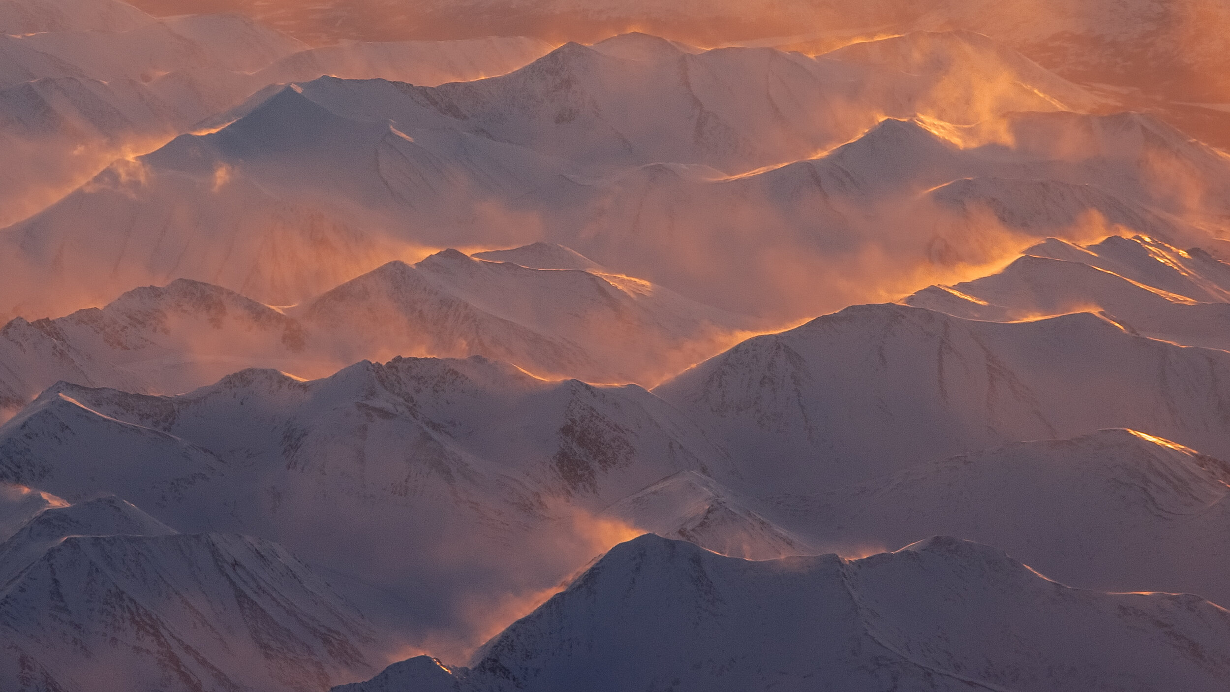
Alaska is home to some of the biggest mountains in the world, including the highest peak in the Western Hemisphere, Denali. Because the base elevation of Denali’s surrounding terrain is relatively low, its vertical relief is also one of the highest in the world, at over 4800m. This relief, along with its heavily glaciated dome, is what gives it its distinctive visual profile (see image above). The vertical distances between peak and valley in this part of Alaska are greater than even those of the central Himalaya, home of the world’s highest mountains. (Everest Base Camp, for example, sits at just under 5200m (18,000’), giving Chomolungma (its indigenous name) an effective vertical of around 4000m). Mount St. Elias in the Alaska Panhandle is similarly scaled, and at over 5500m, has the longest skiable line on the planet, though it has never actually been skied in one go. With its immense scale, its extremely remote location, its uneven topography, its volatile snowpack, and its often severe and unpredictable weather, it likely never will.
The Chugach, a mountainous region in the southern part of the state, between Anchorage and Valdez, is considerably lower in elevation than both Denali and St. Elias. Because of this, and its position immediately adjacent to the salty waters of the Gulf of Alaska, the Chugach mountains receive more annual snowfall than anywhere else in the world, and is the primary base for Alaska heli-skiing (most helicopters cannot operate safely or efficiently above 4,000m*). This is where the world’s first commercial heli-skiing operation began in the early 90s, and where the World Extreme Skiing Championships were held between 1991 and 2000 (and then again in 2011). Doug Coombs, the WESC’s first and most famous champion, founded Valdez Heli-Ski Guides in 1993 and helped jumpstart the industry. After having endured too many close calls with class 4 and 5 avalanches, Coombs moved his guiding operation first to Jackson Hole, and then eventually to La Grave, France, discontinuing his rather gratuitous use of helicopters forever.
-
Alaska’s frequent storm activity and maritime snowpack characteristics mirror those of the Cascades in the Lower 48 (high water content/salinity) but with one critical difference: persistent high pressure systems containing cold dry air tend to follow each storm and suck all the moisture out of the freshly fallen snow. This phenomenon makes for some of the best snow conditions anywhere, and combined with the big glaciated terrain of the Chugach, some of the steepest—maybe the steepest—skiable powder lines on the planet. Unfortunately Alaska has even less infrastructure than Canada, a very short ski season (due to its high latitude), extreme weather, high elevations, and way too many unnamed and inaccessible ski lines to list here. Below is a very small sampling of some that are.
*Above 4,000m, a helicopter’s airworthiness diminishes proportionally to each additional unit of altitude, and becomes acutely sensitive to the destabilizing effects of both increasing air turbulence and the added weight of passengers and gear (not to mention safety personnel and rescue equipment).
⎪ALASKA | The Biggest Lines
• SYMBOLS KEY: Click on the ⚲ symbol for location on Google Maps; info for trip reports; the ▸ symbol for video links; and STRAVA for Strava link/route info
• RATINGS KEY: Exposure: E1=Low, E2=Medium, E3=High, E4=Extreme Distance: S=Slack, R=Remote, VR=Very Remote, XR=Extremely Remote MaxSlope Angle: XX°
• UPDATES: while serious hazards exist on all Biggest Lines ski routes, these route updates provide additional beta from new developments and/or recent trip reports
114. Japanese Couloir, Mount Barrille, Ruth Gorge, Denali National Park, AK ⚲ info info info ▸ STRAVA
115. Kichatna Spires, Kichatna Mountains, Alaska Range, Denali National Park, AK ⚲ info info info info info ▸ ▸ STRAVA
(route update: very serious weather/navigation/avalanche/crevasse/fall hazards)
116. Kahiltna Queen, West Face, Denali, AK ⚲ info info info ▸ STRAVA E4+/XR+/58°
117. Messner Couloir, Denali, AK ⚲ info info info info info ▸ ▸ STRAVA E3+/XR+/61°
(route update: very serious weather/navigation/avalanche/crevasse/fall hazards)
118. Rescue Gully/Orient Express, West Buttress Route, Denali, AK ⚲ info info ▸ STRAVA E3+/XR+/61°
(route update: very serious weather/navigation/avalanche/crevasse/fall hazards)
119. The Ramp, Meteorite Mountain, Chugach, AK ⚲ info ▸ ▸ STRAVA E4/XR+/50°+
(route update: only a handful of known descents on this extremely dangerous, almost unskiable line)
120. The Sphinx, Chugach, AK ⚲ info info info ▸ STRAVA E4/XR+/50°+
121. University Peak, South Face, St. Elias Range, AK ⚲ info info info ▸ STRAVA E4+/XR+/50°+
(route update: only two known descents on this extremely dangerous, almost unskiable line)
BONUS LINE: Mt. St. Elias, Alaska Panhandle, AK ⚲ info info info ▸ ▸ STRAVA E4+/XR+/45°+ (Vertical: 5489m)
(route update: only two known descents on this extremely dangerous, almost unskiable line ; considered to be the longest ski descent in the world.)
*IMPORTANT: Exposure Level and Distance ratings are subjective and do not adequately reflect dangers inherent on approach or egress. Use conservatively.
⎪ALASKA | Maps
State of Alaska
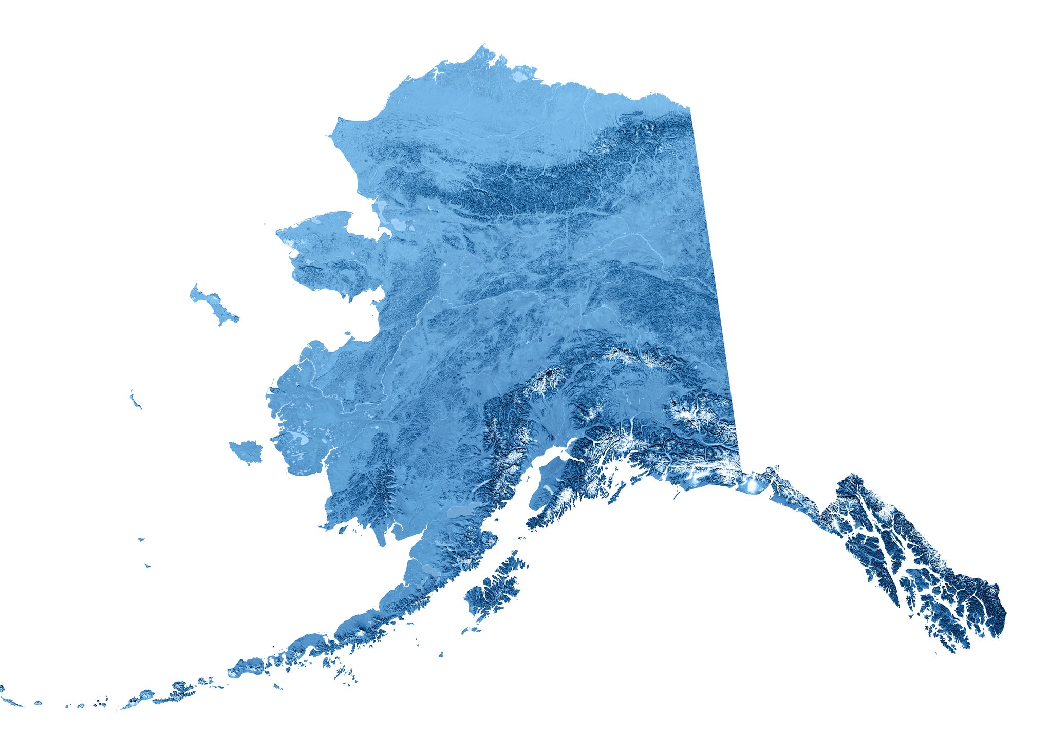
The Alaska Range is the relatively narrow arc of mountains in the south central region of the state of Alaska, and contains the highest mountain in North America: Denali. The Chugach Mountains are the northernmost of the several mountain ranges that make up the Pacific Coast Ranges of the western edge of North America. They are located just to the southeast of the Alaska Range along the southern coast of Alaska. Mount Saint Elias is the second-highest mountain in both Canada and the United States, and stands on the Yukon and Alaska border at the very head of the Alaska Panhandle (at the southern tip of the longitudinal border between Alaska and Canada), and is only 42 km southwest of Mount Logan, the highest mountain in Canada. Click on the image directly for a more detailed Google map.
. . .
Denali National Park
This Denali Landscape Map was originally painted for the National Park Service by Austrian painter Heinrich Berann. Click here for free Interactive/Topographical maps of Denali National Park from the NPS.
Wrangell St. Elias National Park and Preserve
National Park Service map of the Wrangell and St. Elias mountains in the southeast part of the state, including the heli-ski mecca of Valdez, Alaska.
Chugach State Park

Chugach State Park, Alaska Department of Natural Resources (Download PDF here)
—————— SKI ROUTES INDEX ——————
EUROPE: The French Alps
EUROPE: The Alps and Beyond
Canada
Alaska
Colorado
The Tetons
United States: Other
South America/New Zealand/Japan
World's Best Ski Tours